

Walk through Cusco and the ground is doing something most visitors never register. The entire capital was reportedly laid out in the shape of a puma, every neighborhood and temple positioned to form part of the animal’s body. Nothing here got placed randomly. The design connected earth, sky, and mountain in ways the Inca treated as literally as street addresses.
To the Inca this was Qosqo, the Navel of the World, the center of everything that mattered politically and spiritually. The archaeological centers in Cusco weren’t civic buildings in any modern sense. They were a living map where physical structures and distant mountain peaks spoke to each other through sacred geography.
Any wall near the main plaza tells the same compressed story. Smooth fitted stone at the base, Spanish colonial balconies sitting on top of it, two civilizations sharing vertical space with the older one still carrying the weight.

The Secret Behind the Seamless Stones: Why Incan Masonry Withstood 500 Years of Earthquakes
Earthquakes hit Cusco in 1650 and again in 1950, and both times the same thing happened. Spanish colonial walls cracked apart while the ancient stone foundations beneath them held completely. That pattern has repeated enough times across enough tremors that it stopped being surprising and became a documented architectural reality.
No mortar is the reason. Inca builders cut each stone with multiple locking angles so it grips its neighbors from several directions at once. The joints are tight enough that a credit card won’t slide between them, and the whole system moves during a tremor rather than resisting it.
Rigid mortar walls fight seismic energy and lose that fight. The interlocking stones shift slightly, absorb the force, and settle back once the shaking stops. Five centuries of earthquakes have tested this repeatedly and the result keeps coming out the same way.
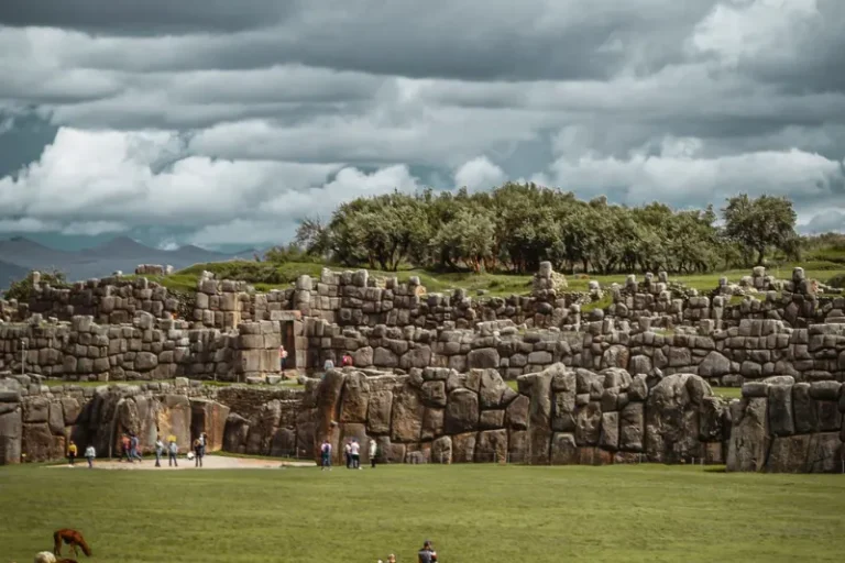
Sacsayhuamán: Walking Through the ‘House of the Sun’ and Decoding Its Monoliths
Twenty minutes up Calle Resbalosa from the plaza, everything learned about the city walls below gets reframed by scale. Some of the monoliths here weigh up to 120 tons and came from quarries well outside the city. The same interlocking system used on the buildings below applies here, just executed on stones the size of school buses.
Getting those blocks to this hillside without wheels or iron tools required log rollers, earthen ramps, and thousands of workers pulling thick woven ropes in coordinated sequences. The logistics behind a single stone are staggering. The fact that hundreds of them were fitted together with this precision is something else entirely.
The zigzag arrangement of the three-tiered walls represents Illapa, the Andean god of lightning. Engineering and spiritual geometry were the same discipline here, which is a pattern that keeps appearing across every major site in the region.

The Vatican of the Andes: The Qorikancha’s Transformation from Gold Temple to Convent
The Santo Domingo convent looks colonial from outside and most visitors walk past without stopping. Step inside and the bottom half of the structure starts telling a different story. The Qorikancha, the Temple of the Sun, stood at this exact location as the spiritual center of the entire Inca Empire before the Spanish built directly over its foundations.
Life-sized golden llamas, cornstalks forged from solid gold, walls reportedly lined with gold sheet. The temple also anchored the ceque system, invisible spiritual lines radiating outward from this point to connect distant shrines across the empire like spokes on a wheel. All of that is gone now except the stonework.
The surviving trapezoidal niches were positioned to capture solstice sunlight and frame specific constellations at specific times of year. The building functioned as an astronomical clock precise enough to track agricultural seasons without a calendar. That function gets embedded into the architecture rather than added on top of it.
The Sacred Valley’s Engineering Masterpieces: Comparing the Defense of Ollantaytambo and the Terraces of Pisac
Pisac works best early in the morning before the tour buses arrive. The agricultural terraces in low light with the valley below still in shadow hit differently than the midday version surrounded by crowds. Look at the cliff face behind the site and the pockmarked holes aren’t natural. They’re tombs, thousands of them, carved into the rock to overlook the farmland below.
Pisac was primarily a farming estate. Ollantaytambo further down the river was a pukara, a fortress, positioned to guard the route toward Machu Picchu. The architectural shift between the two is visible and deliberate, farming curves replaced by military geometry.
A few things at Ollantaytambo are specifically worth finding:
- The Wall of the Six Monoliths: Massive pink granite slabs dragged across the valley without wheels.
- The Water Temple: Stone channels still carrying mountain streams after five centuries.
- The Qollqas: Storehouses perched high on the opposite mountain using freezing winds as natural refrigeration.

Ancient Agricultural Laboratories: How Moray’s Circles Created Miniature Climates
Moray looks like an earthen amphitheater from a distance and photographs consistently fail to explain what it actually was. The concentric circular terraces descending into the earth were a research laboratory for agricultural experimentation, not a performance space or a ceremonial site.
The circular geometry created a 15-degree Celsius temperature variation between the top rim and the bottom floor. Each level functioned as a distinct microclimate, high-altitude potato varieties a few meters above plants requiring warmer conditions. Different ecological zones stacked on top of each other in the space of a short walk downhill.
Porous rock foundations under the deepest circles absorbed excess water before it could flood during heavy rain. The drainage was built into the original construction rather than added as a fix later. That same obsession with water management appears even more explicitly down the road at Tipon.
The Secret of Flow: Inca Hydraulic Engineering at Tipon and the Hidden Gems of the South
Most visitors drive past Tipon without stopping and miss the most impressive water engineering left standing anywhere in the region. Mountain spring water still flows through the original stone channels here, pressurized by elevation drops precise enough to create perpetual fountains from nothing but gravity and correctly placed stone. No modern infrastructure involved, just a system designed well enough to keep running for five centuries.
A few minutes further sits Pikillacta, built by the Wari Empire centuries before the Inca existed. The architectural differences between the two cultures are immediately visible side by side. Rough uncut stones set in mud mortar versus polished precisely fitted blocks requiring no binding material at all.
Seeing both in sequence makes the Inca achievement harder to summarize as simply impressive. Placed next to what came before it, the refinement becomes specific and measurable rather than just aesthetically striking.

Master the Logistics: Navigating the Boleto Turístico and Accessibility
The Boleto Turístico opens most major sites with a single purchase. The full ticket covers 16 sites over 10 days. Partial circuit tickets focus on specific zones, the Sacred Valley or the city ruins, and run one to two days. Which one makes sense depends entirely on how much time is actually available.
For visitors with mobility concerns the options are narrower but real. The Qorikancha has flat smooth walkways throughout. Pisac’s lower terraces deliver strong views without the stair climbing the upper sections require. Knowing which areas are accessible before arriving saves frustration at the gate.
Early morning and late afternoon visits consistently mean thinner crowds and better light. Mid-morning to early afternoon is when tour buses are on site and popular viewpoints hit their most congested point of the day.
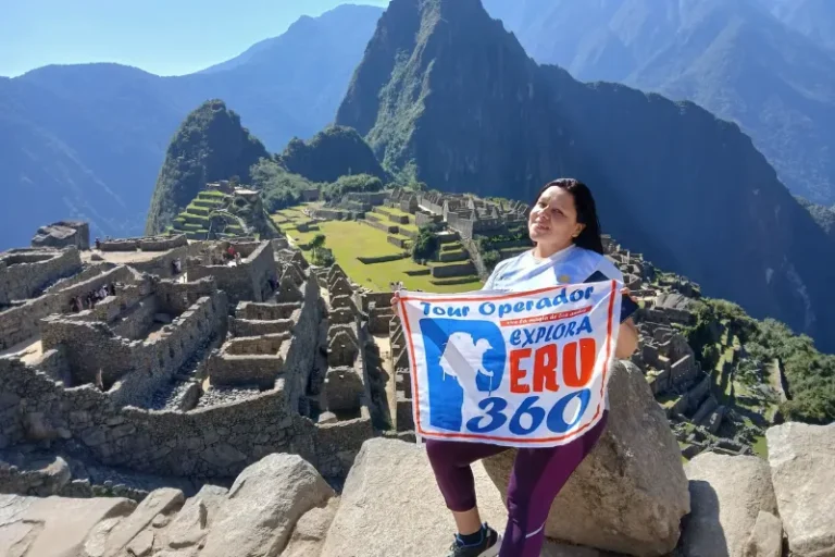
The Remote Rival: Deciding Between the Iconic Machu Picchu and the Rugged Choquequirao Hike
Choquequirao shares an architectural language with Machu Picchu that makes comparison unavoidable. Same gravity-defying terraces, same precisely fitted stonework, same dramatic mountain setting. The buildings say the same things. The experience of being there is completely different.
Getting there requires a multi-day trek with serious elevation change in both directions. That barrier filters visitors more effectively than any quota system. People who arrive feel like they found something rather than visited something, and that distinction matters more than it might sound.
Machu Picchu delivers scale, infrastructure, and context that Choquequirao can’t match. Choquequirao delivers solitude and physical reward that the more famous site stopped being able to offer decades ago. Neither is wrong. They just answer different questions about what visiting these ruins is actually for.

Embracing the Sacred Geography: Ancient Engineering Redefines the Andes
Yanantin, the Inca concept of balance, shaped how these builders thought about the relationship between construction and landscape. Orientation toward mountain peaks, solar alignment, water flow, all of it was part of the same design problem rather than separate considerations.
A three-day approach produces a more coherent picture than rushing everything into one long day. City streets and ancient masonry on day one. Sacred Valley terraces and water channels on day two. A high-altitude site on day three, spent long enough to understand why that location was chosen rather than just what was built there.
The water still flows through the Tipon channels. The solstice light still hits the Qorikancha windows at the same angle it did five hundred years ago. These places aren’t finished being what they were built to be, and visiting them that way changes what the experience actually gives back.